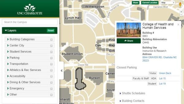
New interactive map to aid navigating campus

On July 15, the UNC Charlotte Facilities Management Department launched a new campus resource aimed at helping faculty, staff, students and visitors explore the campus.
The facilities management information systems team, using Google Maps as a building block, has created an interactive map that offers a wealth of information that individuals can access even before they come to campus.
“Users can search for buildings, parking, dining and information on accessibility and emergencies and more, and they will have live access to campus shuttle information to more easily take advantage of these services,” said Michael Peddycord, a GIS application developer with facilities management information systems.
According to Peddycord, the new map was developed with mobile devices, such smartphones and tablets, in mind. Individuals can share their location when using the map and can obtain turn-by-turn navigation to points across campus.
“Customization and quick updates are among the benefits of the interactive map,” explained Peddycord. In the past, the facilities management information systems team maintained several PDF maps to provide members of the campus community details. “Now, there’s a map that can be updated quickly and allow users to highlight exactly what they would like to see.”